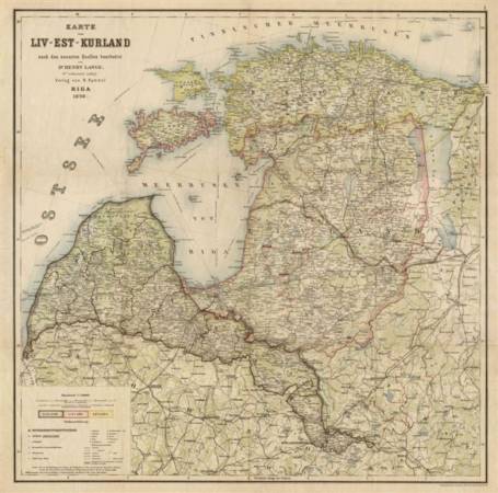
The map displays the Baltic provinces according to administrative subdivision of the Russian Empire before 1917. It covers modern territories of Estonia and Latvia; modern Lithuanian lands are shown without southern and southwestern parts. Inner administrative subdivision of three provinces is shown with special symbol. Additional linear symbol displays a conventional boundary between residential areas of Estonian- and Latvian-native speakers.
Geographical names are given in German for all population centres and geographical objects in three provinces. The part of modern Lithuania is named in old Polish language (German transcription).
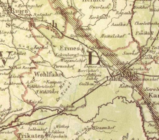
Detailed administrative subdivisions are marked, together with railways, maritime passenger lines, surface roads (with classification to 4 categories). Elevations shown in shading, no hypsographical marks. Additional symbols show castles, churches, factories, etc. Detailed display of areas covered with forests and marshes.
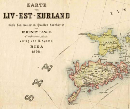
The map was published and, probably, distributed by well-known publisher and bookseller N. G. Kymmel in Riga. The basic cartography belongs to Henry Lange (1821-1893); as the railway network is shown actual to later year, it should be considered that the map originals had been updated after his death
The original preparation and printing was processed by Wilhelm Greve's lithographic factory in Berlin, which had long expierence with maps, albums and postcards.