Eesti merekaardid - Navigational Charts of Estonia


| Publisher: | Eesti Veeteed Amet |
| Pages/Scale: | 1:2'000 – 1:250'000 |
| Language: | Estonian, English |
| Country: | Estonia |
Related Items:
| Image | Title | Category | Price | Buy | |
|---|---|---|---|---|---|
 |
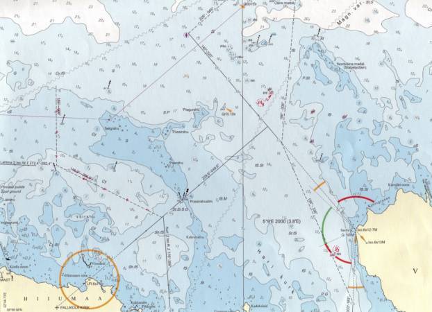
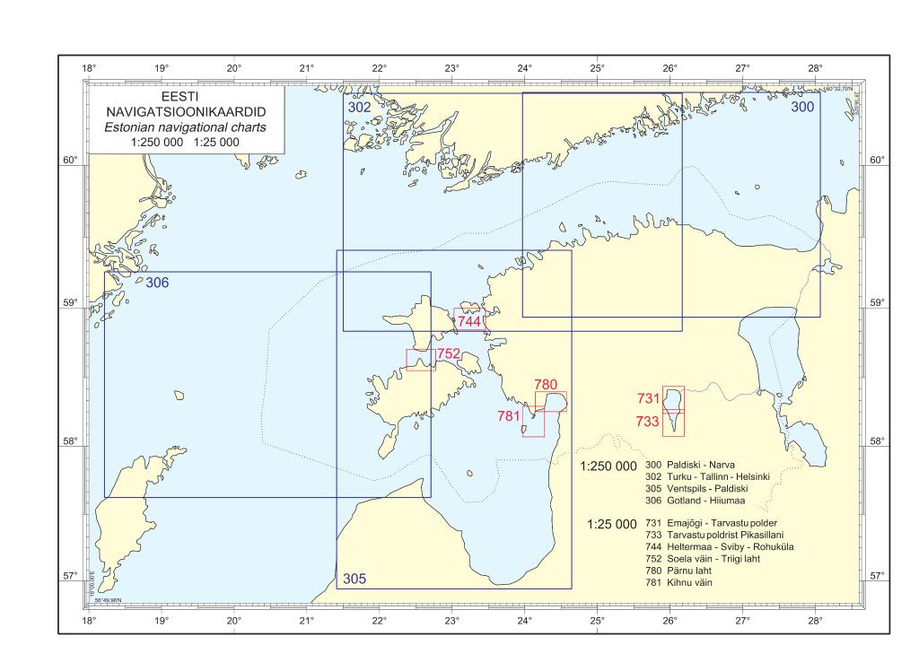
(300) Paldiski - Narva | Nautical maps | EUR 49.99 | ||
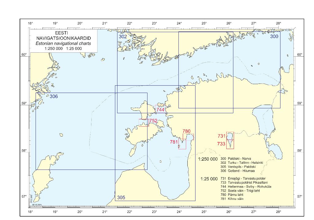 |
(302) Turku-Tallinn-Helsinki | Nautical maps | EUR 49.99 | ||
 |
(305) Ventspils - Paldiski | Nautical maps | EUR 49.99 | ||
 |
(306) Gotland - Hiiumaa | Nautical maps | EUR 49.99 | ||
 |
(502) Kunda - Narva-Jõesuu | Nautical maps | EUR 49.99 | ||
 |
(504) From Muuga to Kunda | Nautical maps | EUR 49.99 | ||
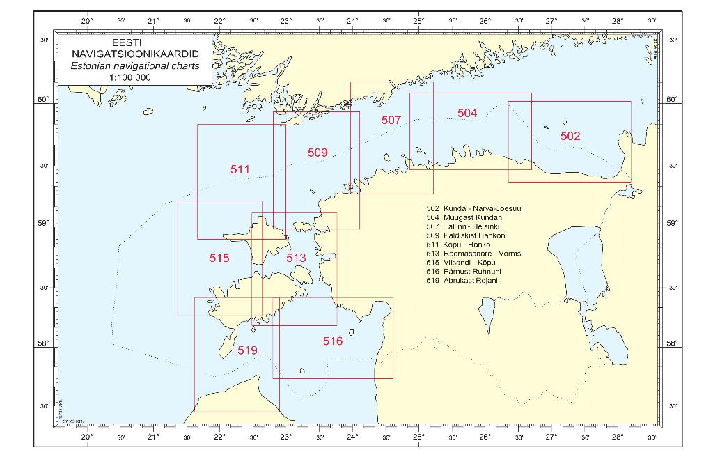 |
(507) Tallinn - Helsinki | Nautical maps | EUR 49.99 | ||
 |
(509) From Paldiski to Hanko | Nautical maps | EUR 49.99 | ||
 |
(511) Kõpu - Hanko | Nautical maps | EUR 49.99 | ||
 |
(513) Roomassaare - Vormsi | Nautical maps | EUR 49.99 | ||
 |
(515) Vilsandi - Kõpu | Nautical maps | EUR 49.95 | ||
 |
(516) From Pärnu Harbour to Ruhnu Island | Nautical maps | EUR 49.99 | ||
 |
(519) Abruka - Roja | Nautical maps | EUR 49.99 | ||
 |
(601) Narva Bay | Nautical maps | EUR 49.99 | ||
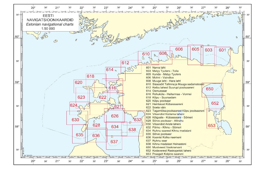 |
(603) Malyy-Tyuters - Toila | Nautical maps | EUR 49.99 | ||
 |
(605) Kunda - Malyy Tyuters | Nautical maps | EUR 49.99 | ||
 |
(606) Mohni - Vaindloo | Nautical maps | EUR 49.99 | ||
 |
(608) Muuga Bay - Hara Bay | Nautical maps | EUR 49.99 | ||
 |
(610) Approaches to Ports of Tallinn and Muuga | Nautical maps | EUR 49.99 | ||
 |
(612) From Keibu Bay to Suurupi Peninsula | Nautical maps | EUR 49.99 | ||
| Eesti merekaardid (64) | Page Nr. 1 no 4 | ||||